“巔峰使命”珠峰科考于2022年4月28日全面啟動(dòng),第二次青藏科考隊(duì)聯(lián)合西藏登山隊(duì),組織了西風(fēng)-季風(fēng)協(xié)同作用、亞洲水塔變化、生態(tài)系統(tǒng)與生物多樣性、人類活動(dòng)變化、地球動(dòng)力學(xué)勘測等5支科考分隊(duì)的16個(gè)科考小組共270余名科考隊(duì)員參與了此次活動(dòng)。“巔峰使命”珠峰科考首次應(yīng)用先進(jìn)技術(shù)、方法和手段,創(chuàng)造了多項(xiàng)科學(xué)考察研究的世界紀(jì)錄:在海拔8830米成功架設(shè)了世界上海拔最高的自動(dòng)氣象站,首次建成了梯度聯(lián)網(wǎng)的巔峰站,實(shí)現(xiàn)了數(shù)據(jù)實(shí)時(shí)傳輸,成為地球之巔科學(xué)燈塔;首次利用高精度雷達(dá)測量了珠峰頂部的冰雪厚度并獲得連續(xù)冰雪厚度剖面準(zhǔn)確數(shù)據(jù);首次取得海拔梯度間隔100米樣品支撐的珠峰頂部冰雪樣品;采用國內(nèi)自主研發(fā)的先進(jìn)儀器首次獲得珠峰地區(qū)地面到上空39公里的臭氧濃度及溫度、濕度、風(fēng)速與風(fēng)向的垂直變化;首次利用直升機(jī)觀測拉薩-珠峰地區(qū)大氣溫室氣體濃度;創(chuàng)造了浮空艇環(huán)境觀測的9032米最高海拔世界紀(jì)錄。“巔峰使命”珠峰科考是自2017年第二次青藏科考啟動(dòng)以來學(xué)科覆蓋面最廣、參加科考隊(duì)員最多、采用的儀器設(shè)備最先進(jìn)的綜合性科考,是人類在珠峰地區(qū)開展極高海拔綜合科學(xué)考察研究的一次壯舉。
World's highest automatic weather station to be set up on Mt. Qomolangma

LHASA, May 1 (Xinhua) -- Chinese scientists are mounting efforts to establish a meteorological monitoring station at an altitude of 8,800 meters on Mount Qomolangma, the world's highest peak, on the China-Nepal border.
If the station is established successfully, it will replace the one at an altitude of 8,430 meters set up by the British and U.S. scientists on the south side of the mountain in 2019, to be the world's highest of its kind, according to the Institute of Tibetan Plateau Research (ITP), Chinese Academy of Sciences.
Equipment weighing some 50 kg will be dismantled and distributed to mountaineers, each of whom will carry no more than 7 kg up onto the mountain for the establishment, said Zhao Huabiao, a researcher with the ITP.

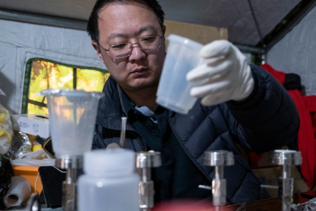
A scientific research member extracts microorganism from glacial meltwater at the Mount Qomolangma base camp on April 30, 2022. (Xinhua/Sun Fei)
Currently, the engineers in charge of establishing the station are still waiting for the perfect weather for mountaineering.
Including the highest, eight elevation gradient meteorological stations will be set up on Mount Qomolangma, one of the main tasks in China's new comprehensive scientific expedition on the world's highest peak at the height of 8,848.86 meters.
Three meteorological stations were established at sea levels of 7,028 meters, 7,790 meters and 8,300 meters, respectively, earlier this year on the north side of the mountain, bringing the total number of operational weather stations between the altitudes between 5,200 meters and 8,300 meters to seven. Last year, four stations at sea levels of 6,500 meters, 5,800 meters, 5,400 meters and 5,200 meters were set up.
The new comprehensive scientific expedition on Mount Qomolangma is part of China's second scientific research survey on the Qinghai-Tibet Plateau, which started in 2017.

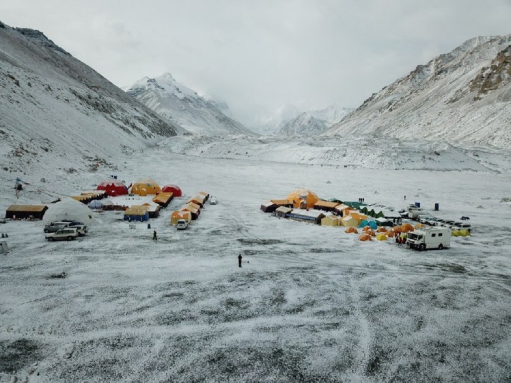
Aerial photo taken on April 30, 2022 shows a view of the Mount Qomolangma base camp. (Xinhua/Jiang Fan)
Zhao said the Qinghai-Tibet Plateau is facing a warming tendency along with global warming, and the higher the altitude is on the plateau, the more the temperature has risen.
Such a conclusion is only based on the data of weather stations at sea levels below 5,000 meters and the estimated calculation in accordance with the remote sensing data, because weather monitoring data from high-altitude stations were missing in the past.
The eight stations will collect the wind speed and wind direction data, as well as relative humidity on the north side of Qomolangma, and the elevation gradient meteorological station system is of great significance for monitoring the melting glaciers and mountain snow at the high altitudes, said Zhao.

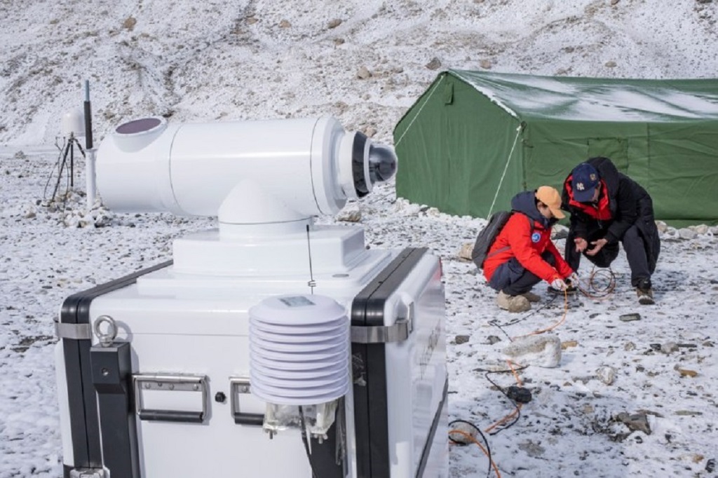
Scientific research members set up a wind lidar at the Mount Qomolangma base camp on April 30, 2022. (Xinhua/Sun Fei)
The expedition team will also set up glacier radar and measure the thickness of snow and ice at the summit of the mountain, he said.